In upstream oil and gas, location is never just geography. Its operational context.
Wells, reservoirs, seismic surveys, facilities, pipelines, and production events all exist in physical space. Understanding how these elements interact is critical for evaluating asset performance, diagnosing production issues, and planning field development.
Yet many mapping capabilities available in analytics tools are designed primarily for visualization rather than analysis.
Spotfire® Industry Pro approaches mapping differently.
As part of the Spotfire visual industrial analytics platform, Spotfire Industry Pro integrates spatial context directly into analytical workflows, allowing energy professionals to explore relationships between wells, reservoirs, and operational data in one environment.
The result is mapping that helps teams discover insights, surface risks early, and drive operations forward.
Spatial intelligence for complex energy workflows
Energy decisions rarely depend on a single dataset.
Production performance is influenced by geological conditions, reservoir behavior, well design, operational interventions, and facility performance. Understanding these relationships requires combining spatial context with operational data.
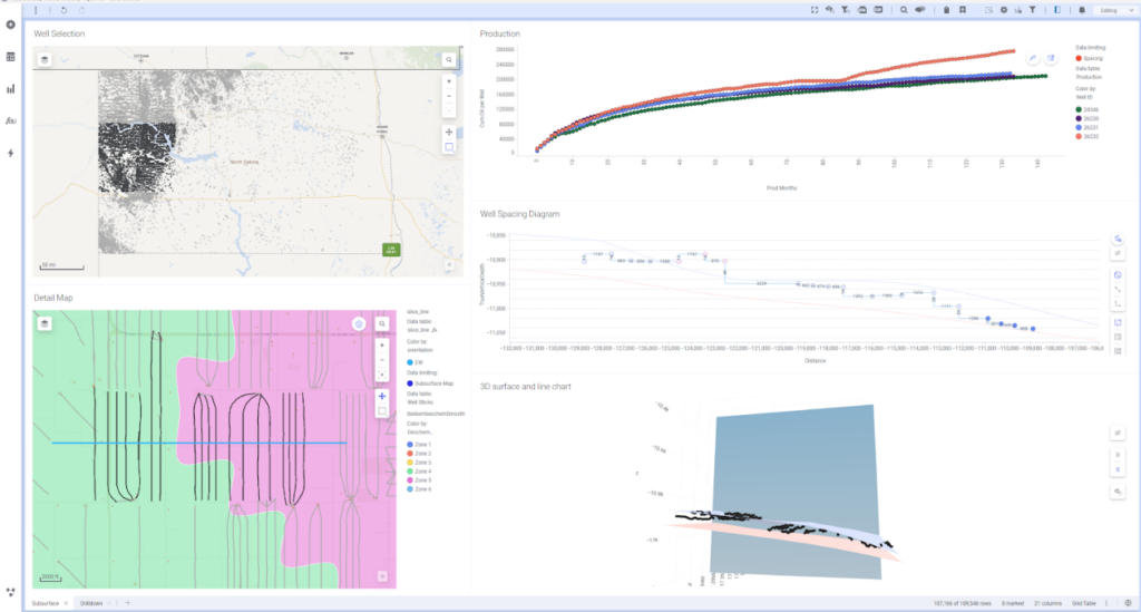
Spotfire Industry Pro maps allow teams to bring these elements together by integrating:
- Well locations and trajectories
- Reservoir and geological layers
- Seismic attributes
- Production and pressure time-series data
- Operational events and interventions
Instead of working across multiple disconnected tools, engineers can explore these datasets within a single analytical workflow, connecting spatial context with operational behavior.
This allows teams to quickly investigate questions such as:
- Why are nearby wells performing differently?
- How are pressure changes spreading across the reservoir?
- Which operational events correlate with production shifts across the field?
By connecting spatial data with operational signals, Spotfire Industry Pro transforms maps from static visuals into interactive analytical environments.
Designed for real energy data
Oil and gas workflows involve complex spatial datasets that go far beyond simple location points.
Spotfire Industry Pro supports these realities with capabilities designed specifically for industrial environments, including:
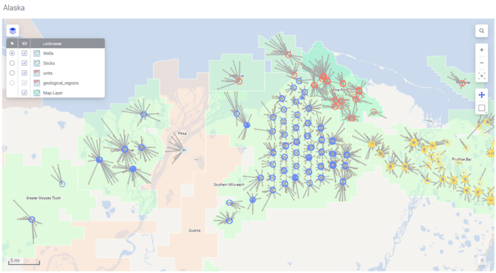
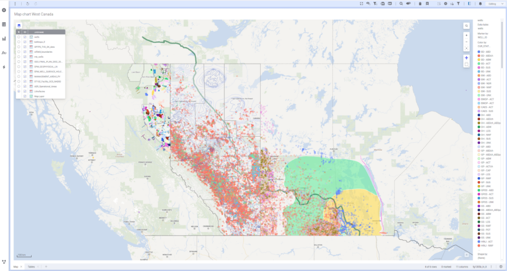
Multi-layer spatial analysis – Overlay wells, reservoirs, facilities, pipelines, seismic data, and operational metrics within the same interactive map.
Integrated time-series exploration- Combine spatial views with production trends, pressure data, and event timelines to understand how asset behavior evolves.
Dynamic linking across analytics – Selections made in the map instantly update connected charts, tables, and models, enabling rapid investigation of patterns.
Advanced analytics within spatial workflows – Apply statistical models, machine learning, and predictive analytics directly within spatial analysis.
Interactive performance at scale – Work with large operational datasets while maintaining the speed and responsiveness engineers expect during analysis.
These capabilities enable energy teams to move beyond simple mapping toward true spatial analysis of operational behavior.
Oil and gas decisions are inherently cross-disciplinary. Reservoir engineers, geoscientists, production engineers, and operations teams all rely on spatial context to interpret data and make decisions.
Spotfire Industry Pro provides a shared analytical environment where these teams can explore the same spatial context while applying their own expertise.
Instead of passing data between specialized tools or static reports, experts can collaborate around a single interactive analysis, improving alignment and accelerating decision-making.
Visual industrial analytics for energy
Spotfire Industry Pro maps are part of the broader Spotfire platform for visual industrial analytics, designed specifically for environments where data is complex and decisions carry real operational consequences.
By combining:
- Interactive visual exploration
- Industry-native analytics
- Advanced analytics
- Explainable intelligence
Spotfire allows energy professionals to connect spatial context with operational data and analytical models in one environment.
The result is faster insight discovery, earlier detection of emerging risks, and more confident decisions across energy operations.
Discover Insights. Surface Risks Early. Drive Operations Forward.
In upstream oil and gas, the ability to see spatial patterns early can make a meaningful difference in operational performance.
Spotfire Industry Pro maps help energy teams:
Discover insights by revealing relationships between wells, reservoirs, and operational signals.
Surface risks early by identifying emerging issues across assets and regions.
Drive operations forward by connecting spatial intelligence with production and development decisions.
Spotfire Industry Pro maps are part of the Spotfire visual industrial analytics platform, designed to help industrial organizations turn complex operational data into trusted insights.
Learn more about how Spotfire Industry Pro supports energy workflows and cross-disciplinary decision-making. Explore and experience Spotfire Industry Pro today.